Posted by Everdien on 6/11/26 • Categorized as PhD
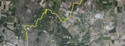
I was just walking. Along the line where the Dutch coast would lie if we didn't engage in coastal defense. The NulNAP line. Seventy percent of that route turned out to run along dikes.

Seventy percent.
I hadn't planned that. I hadn't expected it to affect me either. Because a dike is just a dike. Or so I thought. But after a few hundred kilometers of dike, I started to look at things differently. You walk above ground level. Something on the left, something else on the right. The landscape lies at your feet like a map unfolding itself. And that dike itself—it is silent, but it doesn't lie.
I began to realize that I wasn't walking on dikes. I was walking on the skeleton of the Netherlands.
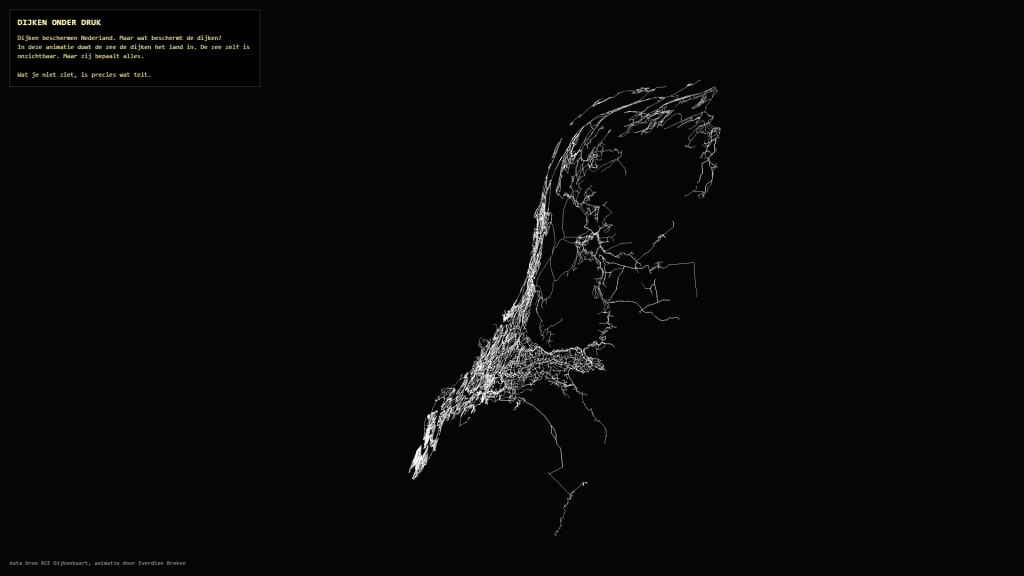
Somewhere along the way, I fell in love with a dataset. That sounds nerdier than it is. Or perhaps exactly as nerdy as it is — I am a nerdy artist, after all. The RCE has produced a book: ‘Dikes of the Netherlands’. With an accompanying dataset: the complete network of all dikes in the Netherlands, from the large sea defenses to the smallest inland dikes. I requested that dataset, opened it, and kept staring.
The network was much more intricate than I had imagined. The Netherlands is not a country with dikes. The Netherlands is a dike landscape. That is a material difference.
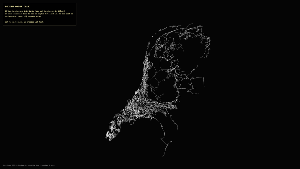
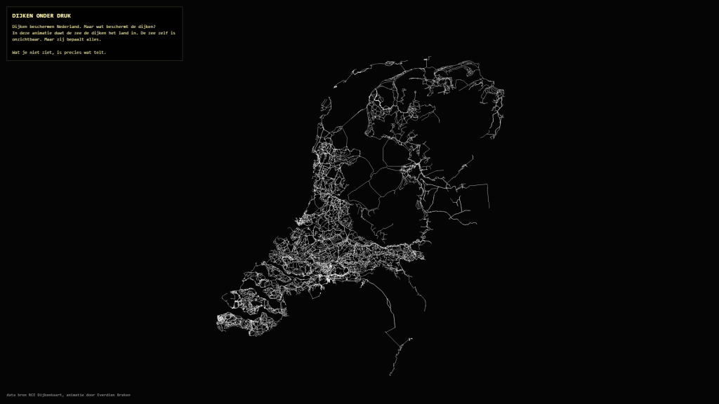
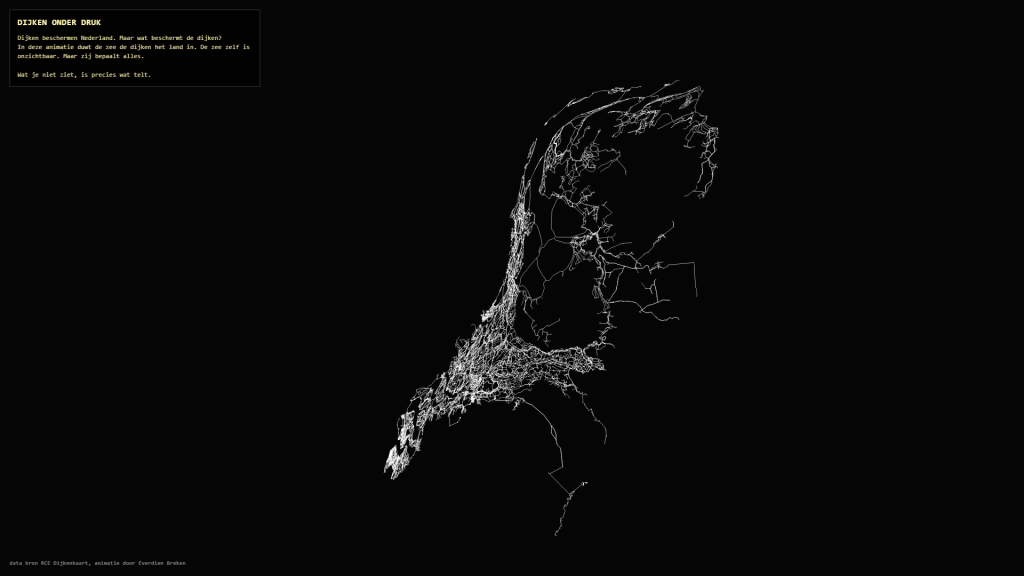
After that, I started making animations. First with restless builders dragging the dikes toward the NulNAP line. Then came this one.
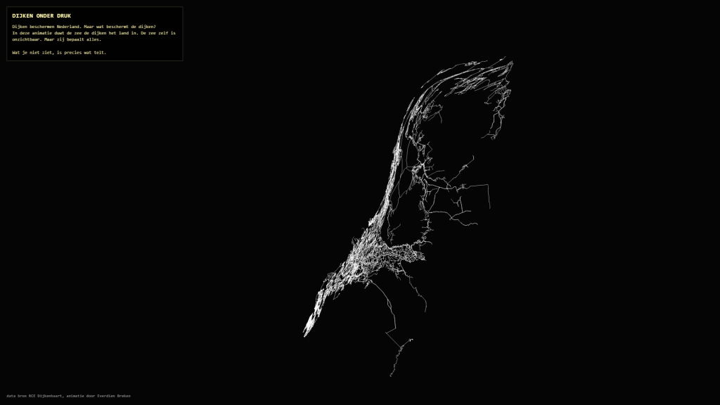
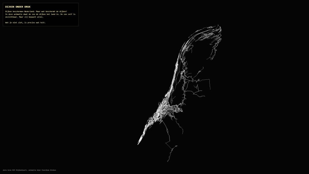
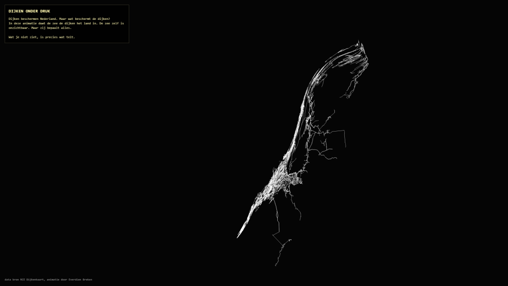
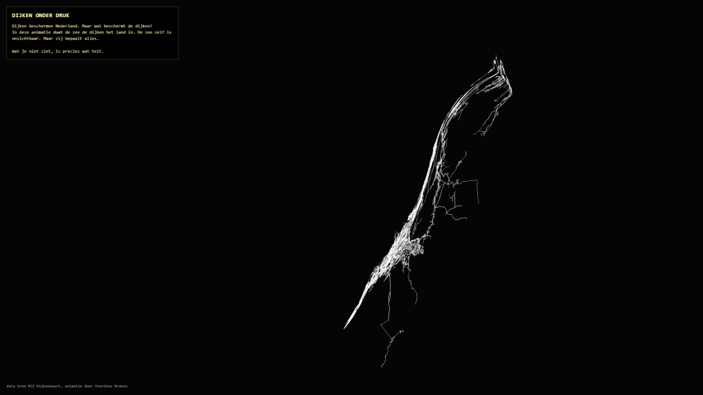
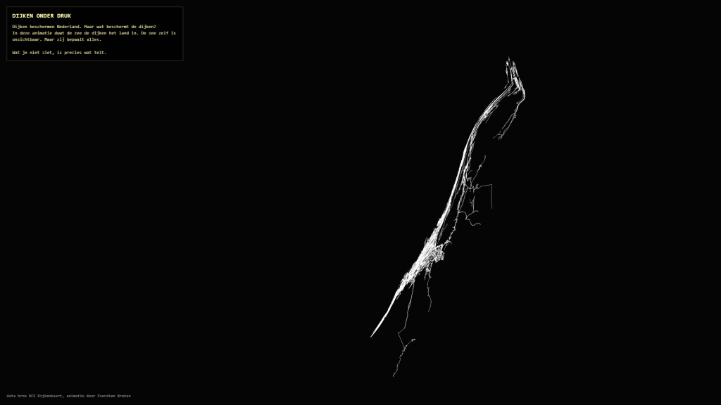
I wanted to know what would happen if the sea reclaimed the land — not as a flood, but as a slow, steady pressure. In the animation *Dikes Under Pressure*, the dikes slide ahead of an advancing sea front, inland, toward the German border. They do not disappear. They do not break. They are pushed aside. The sea itself is invisible. But it dictates everything.
The dikes flee to the east. The Netherlands, the land that has always controlled the water, is here running toward its own border. That image is harsher — and more threatening — than I had expected. I thought I was making an animation with a nice dataset. But somewhere in the making, it became a question: how much longer?
I am not asking that question as an alarmist. I portray her as someone who walks along the NulNAP line and knows how thin the backbone of the Netherlands is. And how beautiful, by the way.