Updated the Heaven and Earth site today using some pictures made by Loes - she's…


Last friday I tried out a new toy I have. I used to be a land surveyor (Delft variety), left school when satellite navigation was just becoming a thing. These days, you buy a GPS – Global Positioning System, navigating from satellites – at Aldi for 45 Euro and the little wristwatch gadget can do (almost) everything that a team of 3 land surveyors in 1985 used to do. And do it in a few seconds, too.
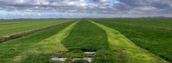
The little girl and I went for a trial run last friday. The GPS recorded our route and times. We explored all these new places so we didn’t make great time – but who cares. On saturday I uploaded the file containing our route to my computer and found out how it can be imported to Google Earth. The picture above is a screenshot made from Google Earth, the blue line is the route we walked. I really need to bow down low to the Google people: this is so cool! Perhaps one has to have struggled with unwieldy surveying equipment for days under the most awful circumstances to get just how great this is. Will find out how I can import Google Earth live into this blog, with the movement it is cooler still.
Anyway, I have the feeling I found a way to write myself on the earth, like this game I played when I was a kid. In my fantasy I made invisible tracks on the earth whenever I walked, and only the right people could see them. I had great fun creating my own networks of roads, even doing labyrinths. Of course I did not know the word then but that is what I did.
This week I will play around with the GPS some more. Having this thing, I can now make a map of the outdoors lab at the Tractieweg by just walking around in it. To be continued!
| « Spatial surprises and city safari’s | <-- previous post | next post --> | Doing research Nomad style » |
|---|